


Introduction
Inertial Navigation Systems in Marine and Submarine Applications play a critical role in modern naval and oceanic operations. These systems allow vessels to determine their position, velocity, and orientation without relying on external signals such as GPS, making them especially valuable in underwater environments where satellite signals cannot penetrate.
What Are Inertial Navigation Systems?
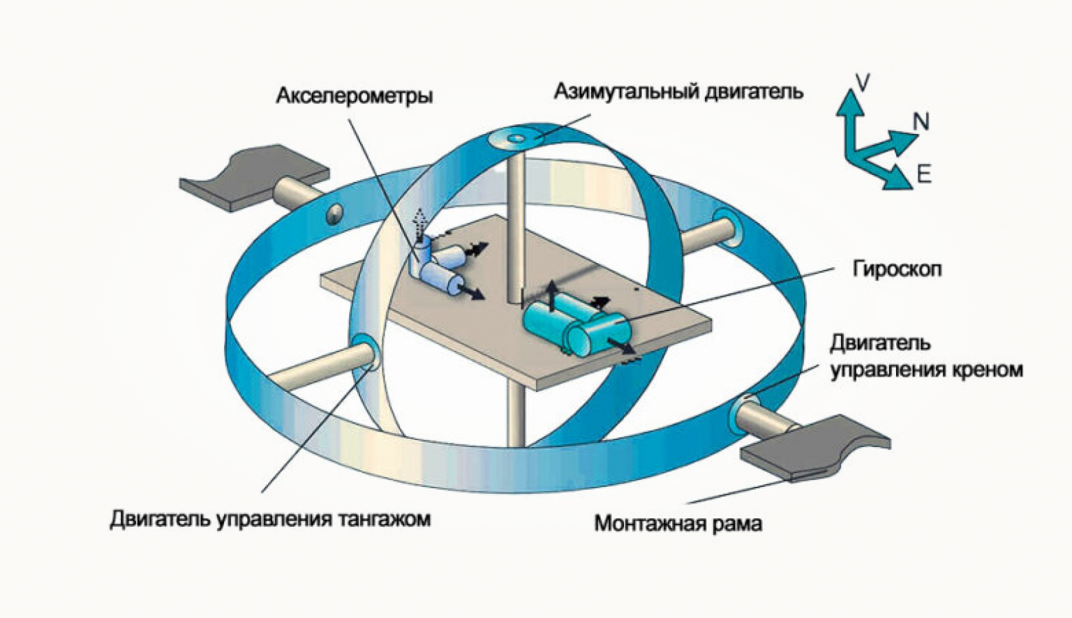
Inertial Navigation Systems (INS) are self-contained navigation technologies that use motion sensors—such as accelerometers and gyroscopes—to continuously calculate the position and movement of a vessel. By tracking acceleration and rotation over time, INS can estimate a vehicle’s current location from a known starting point.
In marine environments, this capability is essential for maintaining accurate navigation during long voyages, rough sea conditions, or when operating in GPS-denied zones.
Importance of INS in Marine Navigation
The ocean presents unique challenges for navigation, including signal loss, weather interference, and the absence of fixed reference points. Inertial Navigation Systems in Marine and Submarine Applications help overcome these challenges by providing continuous and autonomous navigation data.
Ships equipped with INS can maintain course accuracy even during extended periods without external positioning updates. This is particularly important for commercial shipping, research vessels, and military operations.
Role in Submarine Operations
Submarines operate in one of the most challenging navigation environments on Earth. GPS signals cannot penetrate seawater, making reliance on external systems impossible when submerged.
Inertial Navigation Systems in Marine and Submarine Applications are therefore essential for submarine navigation. They enable stealth movement by allowing submarines to operate without surfacing or emitting signals that could reveal their position.
High-precision INS units are often combined with other sensors like depth gauges and sonar to improve accuracy over long missions.
Advantages of Inertial Navigation Systems
There are several key advantages of using INS in maritime environments:
- Autonomy: No dependency on external signals.
- Stealth: Ideal for military submarines due to silent operation.
- Reliability: Functions in extreme weather and underwater conditions.
- Continuous tracking: Provides uninterrupted navigation data.
These benefits make INS a cornerstone of modern marine navigation technology.
Challenges and Limitations
Despite their advantages, INS technology has some limitations. Over time, small measurement errors can accumulate, leading to drift in position accuracy. This is known as “error accumulation.”
To counter this, Inertial Navigation Systems in Marine and Submarine Applications are often integrated with GPS (when surfaced), sonar, or other navigation aids to recalibrate and correct drift.
Future Developments
Advancements in sensor technology, artificial intelligence, and data fusion are improving the accuracy and efficiency of INS. Future systems are expected to reduce drift errors significantly and provide even more reliable long-term navigation for both surface ships and submarines.
Conclusion
In modern maritime operations, navigation precision is essential for safety, efficiency, and mission success. Inertial Navigation System in Marine and Submarine Applications continue to be a vital technology, enabling vessels to navigate independently in some of the most challenging environments on Earth. As technology advances, their role will only become more significant in both commercial and defense sectors.
